


Exploring Wisconsin's Driftless Area: A Fly Angler's Guide
- Jason G. Freund
- Oct 19, 2025
- 9 min read
The Driftless Area covers about 24,000 square miles (over 15 million acres) and goes by many other names - the Coulee Region, bluff lands or bluff country, the Paleozoic plateau, or a host of other names. The Driftless Area occurs because Lake Superior's depth and rift valley along with the highlands between the Driftless Area and Lake Superior helped divert glaciers around this area. Although often treated as a rather homogeneous area, it is much more diverse than we often recognize.

First, some of what we call the Driftless Area is not truly Driftless but was glaciated half a million years ago or so. Because the past glaciations are quite old, they are recognizable by geologists. While Minnesota and Iowa and small parts of Wisconsin and Illinois more accurately have "Driftless-like topography". They look and feel Driftless to the lay-person, like me, and probably you, unless you are a sedimentologist. Even within the Wisconsin and Illinois portions that were never glaciated, there is a lot of variability - that's what I plan to talk about here.

The Paleozoic Plateau is a fitting name as the geology dates back to the Paleozoic Era (538.8 million years ago (Ma) to 251.9 Ma) and the region is a large, eroded plateau. The landscape is shaped by water whereas the surrounding area was largely shaped by glaciers and only more recently has water gone to work on the landscape. This is evident by the fact that glacial rivers have cut deeply through the bedrock which results in bluffs we see today and by the sinuosity and dendritic pattern of these relatively old streams. The rocks of the Paleozoic Plateau are largely sandstones and dolostone (dolomite is the mineral - a magnesium-rich limestone) that date back to when this area was part of a massive sea. The tallest mounds are often capped by relatively resistant dolostone of the Niagara Escarpment or other more resistant layers. You can find fossils in the rocks of the Driftless Area that are evidence of this history.
Because this topic is not really my area of expertise, and it marginally has to do with the fishing I would rather write about; I'll send you to a bunch of links if you care to read on.
Proceedings of the Iowa Academy of Science - Geologic Overview of the Paleozoic Plateau Region of Northeastern Iowa by Hallberg et al. 1984
Minnesota Department of Natural Resouces - Paleozoic Plateau
Driftless Area Magazine - Driftless Drifting- The Hunt for Fossils and What is the Driftless Area?
Wisconsin Geological and Natural History Survey - Finding Wisconsin Fossils
Winneshiek County Conservation - Fossil Hunting in the Driftless
Below is my best attempt at describing the different regions of the Wisconsin Driftless Area. I don't know the Minnesota, Iowa, or Illinois Driftless / Paleozoic Plateau well enough to write about them. I start at the Illinois border and work my way to the Minnesota border near the Twin Cities.
South of the Military Ridge
Grant, Iowa, Lafayette, and Dane Counties
There are a number of cuestas in the Driftless Area, the most obvious of them is Military Ridge. To the south, the slope is gentle and it being south-facing / sun facing, there is a lower density of trout streams. In fact, in the Driftless, this area is one of the best places to fish for Smallmouth Bass (Micropterus dolomieu). The Platte, Grant, Pectatonic, Fever/Galena, and a number of other streams and their tributaries are excellent Smallmouth Bass streams. These bass streams are great for the fly angler and often provide a great deal of access, both by easement or by canoe or kayak. In the map below, where you see valleys but their streams are not designated as trout streams, you are probably looking at Smallmouth Bass streams.

Trout streams south of Military Ridge tend to have a lower gradient and they occur within less steep watersheds. Looking at streams of the south side of the cuesta, they have slopes of less than 2% and watershed slopes in the single digits whereas north of Military Ridge, stream slopes are over 2% and watershed slopes are in the mid-teens. As you move to the East, there is a greater density of trout streams and unsurprisingly, they occur in steeper watersheds.
Trout Unlimited Chapters of the Area
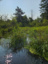
The Heart of the Driftless
Northern Grant, Iowa, Lafayette, and Dane Counties and Richland, Sauk, Crawford, and Vernon counties and southern Monroe, Juneau, and La Crosse Counties


I am going to call The Heart of the Driftless - the area most anglers think of as the Driftless Area - as the area north of Military Ridge to about Interstate 90. By I-90, there is a transition to a landscape that has more sand and is generally a bit less rugged topographically due to the more easily eroded sandstones and lack of the more resistant dolostone. Streams on the northern slope of the Military Ridge cuesta flow to the Wisconsin River. Streams of the rest of the area flow either (eventually) to the Wisconsin or Mississippi rivers. The La Crosse River is approximately the northern edge of this area.

The density of trout streams in this area has to be as high as anywhere in the world. As we often say, if it is a blue line on the map, it probably holds trout. As you can see from the map above, as you move eastward, trout streams become significantly less dense. Maybe the densest concentration occurs in the Kickapoo River Watershed.

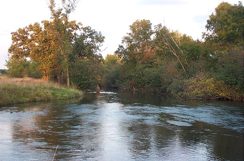
The Kickapoo - the self-proclaimed crookedest river in the world - begins in Monroe County and flows though parts of Vernon, Richland, and Crawford counties. This watershed is rather the heart of the Heart of the Driftless and a lot of tourism activity occurs within the Kickapoo basin. Radiating around the Kickapoo are no shortage watershed with great trout streams - the Bad Axe and Coon Creek watersheds to the west; the Baraboo River, Mill Creek, Pine River, and Willow Creek watersheds to the east, and the La Crosse River to the north.

Due to the dolostone geology, these streams tend to be incredibly productive with high alkalinities. They are classic riffle-run-pool streams, and they are, in general, full of non-native, wild Brown Trout. Highway 14 takes one from Madison to La Crosse and detours off this highway give you tons of fishing options. For many, Viroqua and the Driftless Angler are the functional center of this area. There are fewer bass streams in the area but the Lower Wisconsin River is an amazing bass fishery. A number of trout streams in the area have bass and other warmwater species in their lower ends and fish are constantly moving in and out of the Wisconsin and Mississippi rivers.
Trout Unlimited Chapters of the Area
That Bit Around Devils Lake
Sauk County
The Baraboo Range is that part of southcentral Wisconsin that sticks out like no other area. It is composed largely of Precambrian (before 538.8 mya) quartzite, a highly resistant metamorphic rock, which makes up the ancient mountain. I pull this area out as its own thing because it is quite different, due mostly to the geology. Whereas the rest of the Driftless Area is softer sedimentary rock, the metamorphic quartzite creates a much different landscape.

However, that is not to say that this area is only quartzite. Trout streams of the area often flow through sandstone geology. These streams tend to be small and cold. I have spent much more time in this area hiking, seeing the sights, and being a tourist than I have as an angler. There are some unique streams and a number of Brook Trout streams.


For more about Van Hise Rock, highlighted in the photos above, visit the Wisconsin Geologic and Natural History Survey Upper Narrows and Van Hise Rock document and the Friends of Capital Springs.
Trout Unlimited Chapters of the Area
The Sandy Part of the Driftless
Monroe, La Crosse, Juneau, Jackson, Trempealeau, Pepin, Buffalo, maybe a few other counties
I have a lot less experience fishing these last two parts of the Driftless. Much of my experience is through a graduate research project by a former student (UWL Currents and Thesis) in streams of Monroe and La Crosse counties and comparing them to streams to the south - what I called the Heart of the Driftless above. Through this research, we learned that the streams of the sandstone geology - north of I-90 - run colder and their temperatures are less variable, they are sandier and lack the riffle-run-pool characteristics of the dolostone streams to the south, and Brook Trout were often the only trout species present and they occur in lower densities than they do in the dolostone streams. Because these streams lack much dolostone in their watersheds, they tend to have lower conductivies and are less productive.


As we move further north - that is into Trempealeau and Buffalo counties in particular - I know even less. I know there are some good streams in the area, and they tend to see fewer anglers than do those to the south. I know there are many people doing good work in the area to improve these streams and provide public access to them. There are often a mix of Brook Trout and Brown Trout in these streams. In my limited travels, the closer you get to the Mississippi River, the more rugged the landscape becomes.

The Black, Trempealeau, and Buffalo rivers are a few of the larger streams and watersheds of the area. The La Crosse River, to me, is about the southern end of this region and is another larger watershed in this area. The Black River is a particularly interesting watershed that has some great warmwater fishing in addition to the headwaters and tributatries that are home to trout. I wish I could tell you a lot more, but I don't know much more. I do know that the Trempealeau Hotel is a great place to listen to some music and watch the river.

Trout Unlimited Chapters of the Area
The Northern Driftless
St. Croix, Pierce, and Dunn Counties (primarily)
Again, I am less familar with this area but given the map below and one of the Wisconsin Glacier's extent, the Chippewa River seems like the right place. I have fished this area a bit - largely the Kinni and the Rush - the two best known trout streams of the area and maybe of state. As many that live and/or fish in the area know, these streams are close to the Twin Cities and thus, they receive a lot of angling pressure.

I had not realized until seeing this map how drastically the landscape changes to the west of the Chippewa River. Like Minnesota, this area was covered by previous glaciers, which now seems rather obvious from this map. These streams, in many ways, remind me of streams of the Heart of the Driftless in that they are riffle-run-pool streams that have largely cobble and gravel bottoms. I have only caught Brown Trout but I do know that a number of the other streams in the area and some of the tributaries to the Rush and Kinni hold good Brook Trout populations.


Trout Unlimited Chapters of the Area


You may have come here looking for fishing spots. Sorry to disappoint but I do not do hotspotting. Go fishing and find your own spots! I do hope you came away with a better understanding of the variability within the Driftless Area and have a bit of feel for what to expect when you explore a little more widely. Use the links to the Trout Unlimited Chapters to find contacts to learn more specifics about their area and its streams. Consult the Wisconsin Department of Natural Resources trout surveys and assessments for more specific information (Understanding Fisheries Surveys). Lastly, WDNR fisheries biologists are a great resource - just don't expect them to get back to you quickly during the heat of the field season.
Have fun exploring.