


The 2018 Floods - A Look Back and a Look Forward
- Jason G. Freund
- Sep 21, 2025
- 10 min read
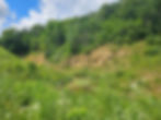
While floods are certainly nothing new to the Driftless Area, the "big one" was 2018 if you lived in the Kickapoo and Coon Creek watersheds. The Driftless Area and the Kickapoo River, in particular, has a long history of big floods. It is a naturally flood-prone area due to the rugged topography, however our alteration of the landscape and climate change have made flooding worse. Add in old and sometimes failing infrastructure, and you have a recipe for disaster, as you will see or perhaps you saw that first hand? Rainfall was the driver of this event - some locations had 48 hour rainfall totals over 20 inches - but other factors certainly exacerbated the effects.

I will attack this topic in the way I know best, with data and other lines of evidence. I am ill-equipped to wax poetically about the devastation of the 2018 floods on people and communities along Coon Creek and the Kickapoo and West Fork of the Kickapoo rivers. Nor was I there. If there is good news from the 2018 flood, it is that, rather miraculously, nobody died in the floods. In Vernon County alone, the costs of the floods were approximately $200 million (PBS - Lessons from a Deluge). And today, we still see the effects of the floods on the landscape, and of course, our streams.
The Flood of Record

The heaviest rainfall occurred approximately where La Crosse, Monroe, and Vernon counties converge - an area approximately along the drainage divide between the Coon Creek and Kickapoo River watersheds. Below is the hydrograph of the event and then another event that occurred about a week after the first flood. This hydrograph is from Steuben as the gage at La Farge was knocked off-line by the flood. Because Steuben is further downstream, the flood peaked later at Steuben.

Below are stage heights and a discharge figure from gages on the Kickapoo River. You will see 2018 is the flood of record at both La Farge, where there has been a stream gage for 85 years, and from Steuben, where there is a much shorter record of coverage.


The discharge of the 1978 flood was the second-largest on record, at about 84% of the 2018 flood's size. Note that due to changes in the channel and having to replace the gage, the 1978 flood's height was not the second-highest flood on record.

Lastly, I share the stage heights at Steuben to show how the floods grow larger as more tributaries enter the river. It does not mean that the flood was more devastating there because other factors - current velocity, valley width and slope, human-built strucutures, etc. - impact the effects of floods. And larger floods may have occurred in some tributaries but 2018 is the largest flood for the Kickapoo River - at least in the 85 years we have hydroghraph records. Journal articles and books about flooding in the Kickapoo River (Happ 1944) and Coon Creek (Potter and Love 1942) date back to World War II and earlier. Flooding is nothing new in the Driftless Area.
Tales From the Flood
Everyone has their own stories from the floods. Mine are mostly around the cleanup, as the night of the big storms, I was safely tucked away in my bed ten miles or more from where the worst of the damage occurred. Probably the two everlasting memories were 1) running a chainsaw in the West Fork Sports Club's clubhouse to tear apart the bar because there had been 3 feet of water inside the clubhouse, and 2) recognizing the jet ski that was on top of a gravestone at the Skogdalen Church on Rullands Coulee because it was the one I had once helped an elderly couple put back in the shed that used to exist along the stream.

Anyone that spent a bit of time in the area after the floods has their memories. Mine are rather mundane compared to those that actually live in the watershed and were directly affected by the flooding. I went to assist with the clean-up efforts in the days and weeks after the floods. That was the extent of my involvement in the flood. I look forward to diving into Tamara Dean's book, Shelter and Storm: At Home in the Driftless - maybe by the time this post is published I will have read it.
I'll share a few videos below and present a few more as links, if you want to go down that rabbit hole.
Links to Videos of the Floods
Links to Flood Stories and Assessments
Record Crests on the Kickapoo from the Aug 28-30 Flood - National Weather Service La Crosse
Kickapoo River Flooding in Gays Mills, Wisconsin - Gays Mills
Dams played a role in historic flood levels - Southwest News 4U
Stories from the flood - Wisconsin Initiative on Climate Change Impacts
The Power of Experience (with Caroline Gottschalk Druschke) - Human Powered Podcast
Long-term Effects on Watersheds and their Streams
While the effects on people is certainly the headliner from the floods, it is time for me to get back into my lane. This is a blog about fly fishing and the surrounding science, after all.

For me personally, the biggest change is what has happened to the West Fork of the Kickapoo River - which I have written about a few times now. While the West Fork still holds trout, the river is a shadow of its former self, and I put most of the blame on the floods and the failed Jersey Valley Dam. The West Fork went from a river with mostly coldwater species to one with a higher percentage of warmwater than coldwater fishes in the seven years since the Jersey Valley Dam gave way. We - Coulee Region Trout Unlimited (CRTU) - are working with the Wisconsin Department of Natural Resources (WDNR) and Vernon County to alleviate the issues. However, quite frankly, what happened to the river below the dam should have never occurred, and it should have never taken so long to deal with it.
Less obvious than the effects of the Jersey Valley Dam failure are how the floods affected the streams. Floods often create stream reaches that are wider and shallower, which warm the streams and create poorer habitat for adult trout. The effects of floods are always interesting, some reaches are negatively impacted, while others reaches are "rejuvenated" and deep pools were left behind. Several off-channel habitats - which usually warm the water for trout but create valuable habitats for amphibians, turtles, and other fishes were created. While the streams were greatly altered, there were reaches that were nearly untouched by the floods. And floods are great for creating new spawning sites and clearing riffles from sediments which allows for greater secondary production. Floods are an interesting thing, ecologically speaking.

Streams will slowly recover on their own, however, we often speed up the process. For a number of reasons, restoring / repairing the West Fork has taken longer than it has in the Coon Creek (Timber Coulee) watershed. Projects on all the major Coon Creek tributaries have occurred since the 2018 floods, whereas work on the West Fork has been limited.

I have mostly written about the Coon Creek and West Fork Kickapoo River watersheds - the two that had dam failures exacerbate the effects of 2018 floods. Many other watersheds were also affected by the 2018 floods. We probably all know of a few stream reaches that are still altered by the 2018 floods - for better or worse. The 2018 floods had massive and widespread affect on streams, roads and bridges, houses and other buildings, and, of course, the streams we fish.
Looking into the Future
For many, streams are not much more than conveyors of water, albeit rather pretty conveyors of water. Not everyone cares much about trout, fishing for them, or fly-fishing (I know, right!). But everyone has some reasons they value streams. For many, those reasons are aesthetic - streams are unquestionably "pretty". They bring significant economic value to the Driftless Area - over $1.6 billion in 2016 (we are due a new economic study) - and many value that. Others recognize that streams have intrinsic value and are an important part or our environment, and it is our responsibility to pass down clean, functional streams to future generations. Anyone reading this values the recreational of streams and we all spend time on them for our own reasons. And streams are conveyors of water, sediments, and organic matter. In healthy conditions, they do a better job of conveying water - which means they protect communities, infrastructure, and other things of value.

Look at our history of how we have dealt with streams does not paint a pretty picture. We straightened them in the name of flood conveyance, only to figure out that was counterproductive. We allowed an unimaginable number of tons of sediment into their valleys, forever changing them, and making them more likely to flood catastrophically. We put bridges and culverts that are too small over them - then we curse the streams that ruin that infrastructure. And we allow all sorts of pollutants - from sediments to chemicals - to enter these streams because streams help those things "go away".

It is 2025 and maybe we are learning our lessons from abusing our streams. The 2018 floods were certainly an eye-opener for many and resulted in some changes. In the West Fork and Coon Creek watersheds, it has resulted in an assessment of the PL566 structures and their role in flooding. Originally built as flood control structures, they are at the end of their expected lives. Couple that with the failure of five of these dams and the additional damage that caused and could cause in the future; it has made people rethink their effects. We are in the middle of a dam decommissioning process that has moved at a governmental pace. Vernon County has decommissioned one of the failed dams, Milsna Dam in the West Fork watershed, and is working to secure funding to create plans to remove the other PL566 structures and rebuild the Jersey Valley dam (maybe we didn't learn so much after all...). By now, you are probably thinking to yourself, "Hasn't it been 7 years since the 2018 flood?" and indeed it has. I said things are moving at a governmental pace.

On what I view as more promising notes, the counties in these watersheds have been more forward-looking and actively working to improve infrastructure and make it more resilient to flooding. Vernon County secured a pre-disaster flood resliency grant through the state and Monroe County recently was awarded a The Promoting Resilient Operations for Transformative, Efficient, and Cost-saving Transportation Program (PROTECT) grant for the Little La Crosse River watershed. The Vernon County grant will help fund H&H (hydraulic and hydrology) studies that are required for work to be done on streams and their crossings. The Valley Stewardship Network (VSN) along with the Coon Creek Community Watershed Council - an organization that came out of the effects of the floods, are working on a 9 Key Elements Plan for Timber Coulee. La Crosse County, through a Targetted Runoff Management (TRM) grant, has been working on small watershed projects along with stream work in the Bostwick Creek watershed that has really improved that stream and watershed. As you can see, a lot is happening and much of it is proactive.
I am certainly a bit less than thrilled with what has occurred in the West Fork watershed to date but we are seeing action there too - it is just happening more slowly than I would like. With Vernon County being able to fund H & H studies, this will help both in-stream improvements as well as infrastructure improvements to begin soon. In the Coon Creek watershed, the community has really rallied around the stream and watershed after the flood. It is a point of pride that they were the nation's first watershed program. Across the rest of the Driftless, much good has and is being done.

The 2018 floods provided a bit of a shock to the system. It is certainly not that people did not think it could happen but it is hard to imagine until it does happen. That is the thing with floods, they are so unpredictable. We could have another 2018 this year or we might never see anything like 2018 again. Our best hope is to do as much as we can to make those watershed more resilient to flooding. What we have done in the past is often working against our current efforts. What happens with flooding into the future is unknowable, all we can do is create an environment where streams are able to effectively convey water and sediments.